Results
GRANULAR is developing different tools to shed light on the multiple dimensions of rurality from a comprehensive spatial perspective.
Rural compass
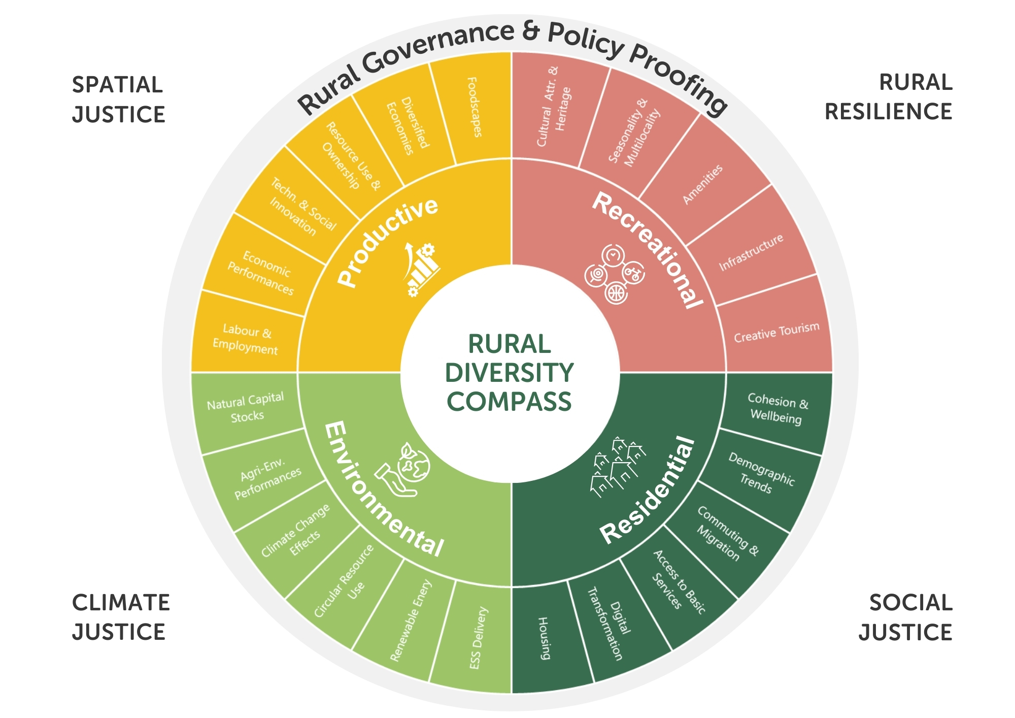
The Rural Compass is a tool aimed at orientating and providing policy direction, going from policy design in rural areas to policy monitoring and evaluation. The Rural Compass is conceived as a four-dimensional tool, based on a distinction of four principle rural functionalities that are further characterised in several components:
- Residential functionalities
- Productive functionalities
- Environmental functionalities
- Recreational functionalities”
The compass enables stakeholders to systematically evaluate the place-specific differentiation tendencies based on particular functionality dynamics of rural areas, considering various perspectives, and thus aligning policy goals with the needs of the community. By using this structured approach, planners can ensure that their efforts are both strategic and responsive to the unique challenges of rural areas, ultimately leading to more effective and impactful outcomes

Rural proofing mechanisms
Rural proofing is the process of reviewing policies through a rural lens and to make these policies fit for purpose for rural communities. GRANULAR is developing a methodology and toolkit to guide the implementation of rural proofing. This work will be built on the framework set by our Rural Compass, as well as take inspiration on other existing rural proofing toolkits in Europe and beyond.
Digital platform
GRANULAR is developing new datasets to characterise rural areas. Our Digital Platform is an online interface to give open access to these datasets. The Digital Platform is particularly designed for local actors located in rural areas, such as – but not limited to – community groups, decision-makers, policymakers and citizens.
Our Digital Platform will continue to grow and evolve until the end of the project. New datasets will be linked and added by our team.
Data Fiches
GRANULAR data fiches provide simple and clear information about different datasets for better understanding rural areas.
These fiches cover a wide range of topics, including accessibility, agriculture, climate, demographics, and more. They are organised according to the four functionalities of rural areas, namely environmental, productive, recreational, and residential functions.
They provide details on the type of data available, when and where they were collected, a brief description, and how to properly cite it if you use it in your work. They also cover costs, so you know if there are any fees associated with accessing or using the data. While many datasets are free, there may be costs related to analysing the data or ensuring its quality.
Whether you’re a researcher, student, or just curious about data, the fiches are here to help you make the most of the available information.

Briefs, reports and analyses
Providing in-depth assessment and understanding on the interrelations between rural areas and specific topics (climate, resilience, food, well-being, policies, rural proofing)
GRANULAR is producing new datasets, indicators and tools to drive place and evidence-based decision-making in rural areas. A big chunk of our work is to analyse, assess and explain to others the outcomes of what we have produced and learned with other rural actors.
To this end, we are producing policy briefs, thematic reports and analyses on a number of key topics for rural areas. Some of the topics to be addressed are environmental resilience and climate hazards in rural areas, socio-economic cohesion, rural attractiveness and perceptions.
Available soon!